Bright blue pool surrounded by white walls and palm trees

Map & location

Timanfaya National Park Map: Where It Is and the Volcano Route

Secure payment 5,000+ travellers have booked

Powered by GetYourGuide

The day's route

Stop by stop

  1. 61 pickup location options

    Muelle Playa Blanca, Cactus Jacks, Hotel San Antonio Vuelta and 60 more

  2. Timanfaya National Park100 minutes

    Guided tour, Bus tour

  3. Cueva de los Verdes55 minutes

    Guided tour

  4. Jameos del Agua55 minutes

    Visit

  5. 61 drop-off locations

    Bus Stop C.C. Biosfera, Gran Castillo Tagoro Family & Fun, Playa Blanca and 60 more

Mapping data © OpenStreetMap contributors, ODbL

The essentials

  • Timanfaya lies in the municipalities of Tinajo and Yaiza, reached by the LZ-67 road that links the two towns.[1]
  • MITECO gives the park a total surface area of 5,107.50 hectares, and its highest point, Timanfaya, reaches 511 metres.[2][3]
  • The Taro de entrada gate is 2.5 km past the Echadero de los Camellos from Yaiza, or 4.5 km from Mancha Blanca.[4]
  • The Route of the Volcanoes is a 12 km circular route by the park authority's figure, and around 14 kilometres by CACT's.[5][6]
  • MITECO gives Mancha Blanca's address as Ctra. Tinajo-Yaiza, Km 11,500, 35560 Tinajo, just outside the park boundary.[4][7]
 Montañas del FuegoMancha BlancaEl Golfo
WhereIslote de Hilario, core of the site[8]Ctra. Tinajo-Yaiza, Km 11,500, Tinajo[7]Yaiza's west coast, in the natural park[9]
Road or pathLZ-67, 2.5 km past the camel station[4]LZ-67 towards Tinajo[4]End of the long coastal route on foot[10]
PositionIts gate is 4.5 km from Mancha Blanca on the LZ-67[4]Outside the national park boundary[4]Start of the 2 km short coastal route[11]
What is thereCoach route, geothermal demos, restaurant[6][8]Free exhibition and audiovisuals[12]Charco de Los Clicos green lagoon[9]
Tours that stop thereVolcanic Craters Tour, from US$68[13]4x4 north tour, from US$78[14]Full-day tour with El Golfo, from US$86[15]

Traveller scores for a tour that covers the park

4.5 2,662 travellers
Guide 4.5
Transportation 4.6
Value for money 4.4

GetYourGuide traveller scores for the Timanfaya, Jameos and Cueva de los Verdes tour booked from this site.

Timanfaya National Park is one of the most impressive volcanic landscapes in the world. Its eruptions, which took place between 1730 and 1736, forever transformed the centre-west of Lanzarote
Turismo Lanzarote Lanzarote's official tourism boardturismolanzarote.com
Among the nearly seventy geosites, the most significant is Timanfaya, home to numerous volcanic structures and one of the largest historic lava fields in the world.
UNESCO Lanzarote and Chinijo Islands Global Geopark pagewww.unesco.org

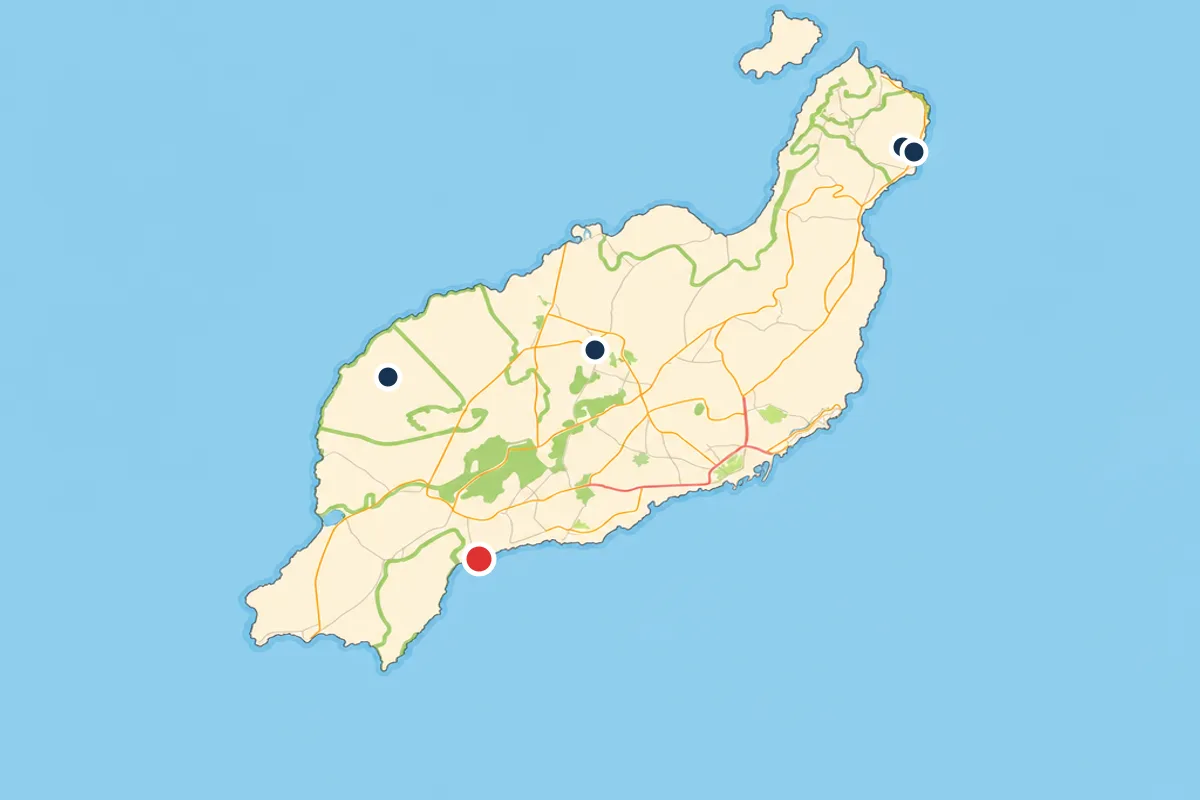
Three points to find on the map: Hilario, Mancha Blanca, El Golfo

Montañas del Fuego coach route and geothermal demonstrations from €30
Mancha Blanca free visitor centre outside the park boundary
El Golfo start of the guided short coastal route
Guided day tour Timanfaya, Jameos del Agua and Cueva de los Verdes from US$102

Key map points

  • Visitor centre: Ctra. Tinajo-Yaiza, Km 11,500, 35560 Tinajo.[7]
  • Park office: C/ La Mareta, 9, 35560 Tinajo, open Monday to Friday.[1]
  • Entrance gate: 2.5 km past the Echadero de los Camellos from Yaiza.[4]
  • Coaches: from Islote de Hilario every 20 minutes.[16]

Size and shape

  • Total park area: 5,107.50 hectares.[2]
  • Highest points: Timanfaya at 511 m and El Señalo at 507 m.[3]
  • Sea of lava habitat: roughly 70% of the park.[17]
  • Free access on foot: only along the coastal path.[4]

Where is Timanfaya National Park?

Timanfaya National Park lies in the municipalities of Tinajo and Yaiza, and Turismo Lanzarote says its eruptions, between 1730 and 1736, forever transformed the centre-west of Lanzarote.[1][18] The LZ-67, the road between Tinajo and Yaiza, gives access to the park's different facilities.[1]

Yaiza holds 2,901 hectares of the park, more than half of its total area.[9] Around it, the Parque Natural de los Volcanes, declared in 1994 and covering 10,158.4 hectares, forms a wide ring that surrounds the national park.[9]

The 1730-36 eruptions left a sea of lava of about 174 square kilometres over part of the west of the island and gained new land from the sea, and MITECO's history says they affected a quarter of the island's surface.[19][20]

Timanfaya National Park location and address

The Timanfaya National Park address for the visitor centre, as MITECO gives it, is Ctra. Tinajo-Yaiza, Km 11,500, 35560 Tinajo, Lanzarote.[7] The park's administrative offices are at C/ La Mareta, 9, 35560 Tinajo, open Monday to Friday from 9:00 to 14:00, or 9:00 to 13:00 in summer.[1]

Montañas del Fuego is reached along the same road. Coming from Yaiza, the Taro de entrada gate to the Montañas del Fuego tourist centre is 2.5 km past the Echadero de los Camellos, and coming from Tinajo it is 4.5 km beyond the Mancha Blanca visitor centre.[4]

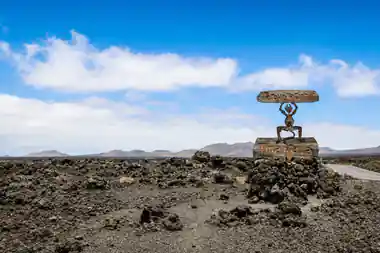
Past the gate, visitors stay in the vehicle from El Taro to the car park on the Islote de Hilario, the core of Montañas del Fuego, with a cafeteria, a restaurant, a souvenir shop and toilets.[6][8] Signs with César Manrique's El Diablo logo, made from the timber of broken-up boats, stand at the access points to the park.[4] The devil sculpture, the symbol of the National Park, welcomes visitors on the road to Montañas del Fuego.[6]
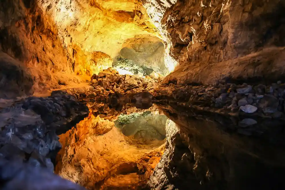
Golden cave interior with water reflection and rock formations

Craters and lava fields of Timanfaya National Park

How big the park is

On MITECO's technical fact sheet, the Timanfaya National Park size is a total surface of 5,107.50 hectares.[2] The park was declared by decree on 9 August 1974, reclassified by law on 25 March 1981, and designated a Biosphere Reserve in 1993.[2]

The land rises from sea level to the Timanfaya-El Señalo massif, whose highest points reach 511 and 507 metres above sea level.[3] The sea of lava habitat covers roughly 70% of the park, and the cones and hornitos habitat about 20%.[17] The park's most characteristic hornito, a secondary vent that built no large volcanic edifice, is called Manto de la Virgen.[21]

About 5% of the park is private land where traditional crops survive behind volcanic-stone walls, around Montaña Tremesana, María Hernández and Pedro Perico in the south and the Miraderos zone in the east.[22] Of the 1824 volcanoes, only the westernmost, Chinero, and its lava flows lie within the park's current boundaries.[19]

The Route of the Volcanoes

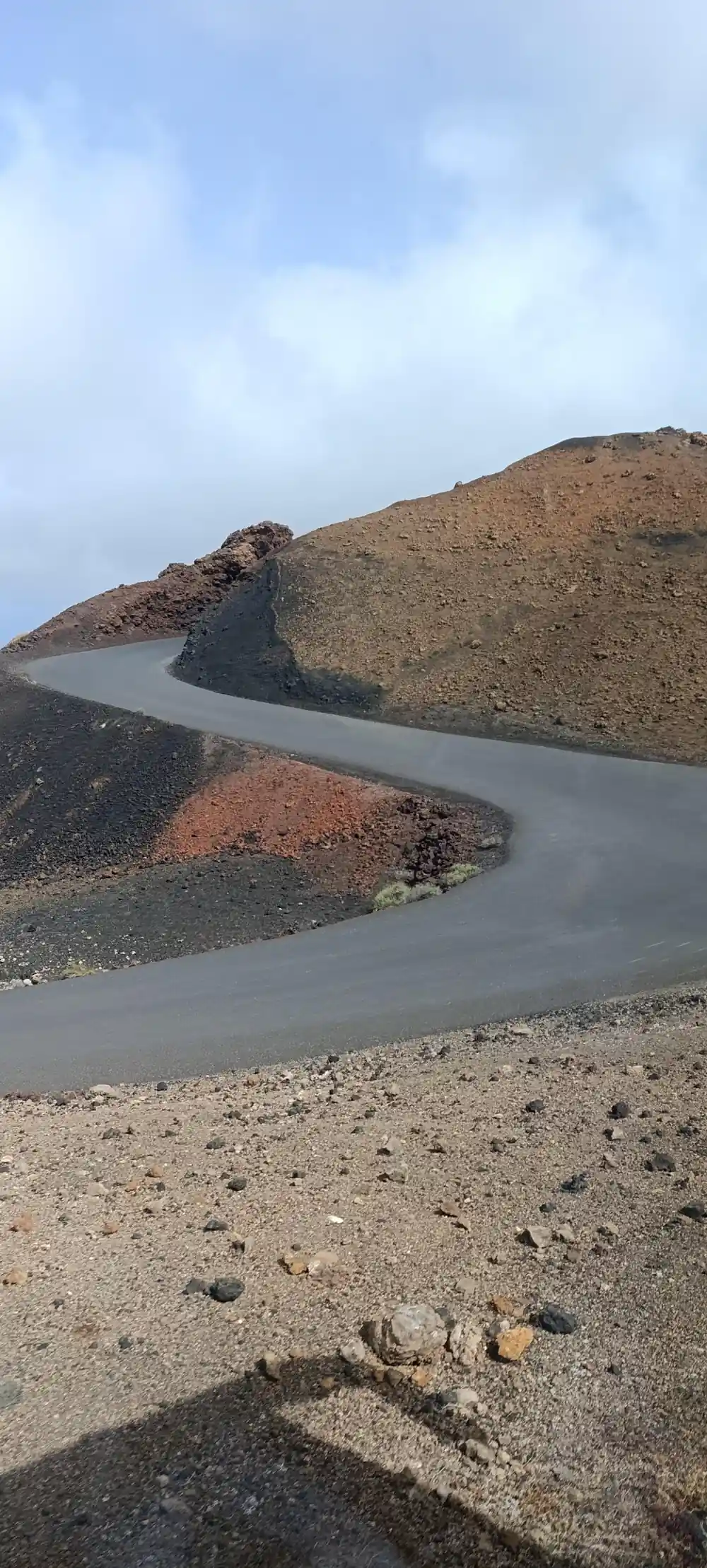
The Timanfaya National Park route included in the ticket is the Route of the Volcanoes, a coach route conceived by César Manrique and accompanied by an audio narrative.[6] CACT describes it as around 14 kilometres through the main core of the eruptions, while the Canary Islands park authority gives a circular route of 12 km and 45 minutes, between 251 m and 453 m of altitude.[5][6]

The coaches leave Islote de Hilario every 20 minutes, according to CACT's FAQ.[16] On the route, the Valle de la Tranquilidad is named after the Moon's Sea of Tranquility, where Apollo 11 landed, and from Islote de Hilario the view opens onto a sea of lava with more than 25 craters in just a few square kilometres.[6]

The route is not open to private cars: CACT says the park may not be explored freely by car or on foot, and the park authority says the guided routes run on foot or aboard the park's internal buses.[1][16] CACT lists the route's audio guide in Spanish, English and German in its What to do list, but in Spanish and English only in its FAQ.[6][16]

5,107.50 ha

The total surface area of Timanfaya National Park on MITECO's technical fact sheet.[2]

Geothermal hot spots and the camel station

Besides Islote de Hilario, the park's most important geothermal anomalies, with surface temperatures above 100°C, are at the Casa de los Camelleros and on the floor of the Timanfaya crater.[19] The park's module of the Laboratorio Geodinámico de Lanzarote is housed in the Casa de los Camelleros.[23]

At Islote de Hilario, IGME's description gives about 250°C at the surface and more than 600°C at 13 m, while its own scientific section gives 100 to 120°C at the surface and 610°C at 13 m.[24] IGME explains the heat by a residual magma chamber at around 2-4 km depth.[24]

The camel ride is a circular route on the south slope of Montaña de Timanfaya, lasting about 20 minutes by the park authority's figure, while the Ayuntamiento de Yaiza puts it at between 20 and 25 minutes.[25][26] The Echadero de los Camellos, where it starts, sits on the LZ-67 2.5 km before the gate when you come from Yaiza.[4]

El Golfo and the coast

On foot, free access to the park is permitted only along the coast, on a path that runs the length of the park's coastline.[4] The long coastal route, self-guided with free access, runs 9.75 km from Playa de la Madera in Tinajo to Punta del Jurado inside the park and ends in the village of El Golfo, a walk of 5-6 hours.[10]

The short coastal route is guided and needs a prior booking, covering 2 km in about 2.5 hours from El Golfo to near Playa del Paso.[11] The compulsorily guided Tremesana route covers 3.5 km and meets at Plaza de los Remedios in Yaiza.[27] El Golfo sits on Yaiza's west coast inside the Parque Natural de los Volcanes, and its Charco de Los Clicos lagoon, green from plant organisms in suspension, is separated from the sea by a sand beach.[9]

Also on Yaiza's west coast, Los Hervideros is a stretch of cliffs with caves and blowholes formed by the 1730-1736 eruptions and sculpted by erosion.[9] The Lanzarote Film Commission counts the Charco de los Clicos viewpoint as the backdrop for 14 different films.[28]

Distances from the resorts

Rome2rio gives the driving distance to the park as 20 km from Playa Blanca, about 26 minutes, 21 km from Puerto del Carmen, about 33 minutes, and 28 km from Lanzarote Airport, about 37 minutes.[29][30][31]

From Arrecife it gives 33 km, about 41 minutes, from Arrecife Port 34 km, about 43 minutes, and from Costa Teguise 39 km, about 46 minutes.[32][33][34] The park authority's best access from Costa Teguise runs via the LZ-20 to Tinajo and visits the Mancha Blanca centre first.[4]

Without a car, no public transport enters the park; line 16 serves Mancha Blanca and lines 6 and 61 serve Yaiza.[1][35][36][37] The tour booked from this site lists 61 pickup location options and stops at Timanfaya National Park, Cueva de los Verdes and Jameos del Agua, from US$102.[38]

Heights on the Timanfaya map, in metres

Timanfaya summit 511 m
El Señalo summit 507 m
Volcano route, highest point 453 m
Volcano route, lowest point 251 m

Heights above sea level from a University of La Laguna paper and the park authority's route page.[3][5]

Price a tour that covers these map points

Each amount is that listing's own "from" price in US dollars, and the calculator applies the same listed figure to every traveller.[13][14][15][38][39]

Timanfaya, Jameos & Cueva, 9hUS$204
Timanfaya & Jameos full day, 9-10hUS$172
Timanfaya & El Golfo, cruise morningsUS$140
Volcanic Craters Tour, 5hUS$136
4x4 Volcanic North, 6hUS$156

Map distances worth knowing

2.5 kmFrom the Echadero de los Camellos to the Montañas del Fuego gate, coming from Yaiza.[4]
4.5 kmFrom the Mancha Blanca visitor centre to the Montañas del Fuego gate on the LZ-67.[4]
12 km or 14 kmLength of the Route of the Volcanoes, per the park authority and CACT.[5][6]
9.75 kmThe self-guided long coastal route, which ends in the village of El Golfo.[10]
20 kmRome2rio's driving distance from Playa Blanca to the park.[29]

Following the map by road

  1. Take the LZ-67

    The LZ-67, linking Tinajo and Yaiza, gives access to the park's facilities.[1]

  2. Pass the Echadero de los Camellos

    From Yaiza, the camel station comes 2.5 km before the Montañas del Fuego gate.[4]

  3. Enter at the Taro de entrada

    Stay inside the vehicle from El Taro to the Islote de Hilario car park.[6]

  4. Ride the Route of the Volcanoes

    Coaches leave Islote de Hilario every 20 minutes for a tour of approximately 40 minutes.[16]

  5. Continue to Mancha Blanca

    The visitor centre is 4.5 km beyond the Taro gate on the LZ-67 towards Tinajo, outside the park boundary.[4]

See the Route of the Volcanoes on a guided Timanfaya day tour

See tour dates

from US$103Reserve now & pay later
Good to know first

Which part of Lanzarote is Timanfaya in?
It lies in the municipalities of Tinajo and Yaiza, and Turismo Lanzarote says its eruptions, between 1730 and 1736, transformed the centre-west of the island.[1][18]
How big is Timanfaya National Park?
MITECO gives a total surface area of 5,107.50 hectares, and Yaiza municipality holds 2,901 hectares of it, more than half of the total.[2][9]
What is the visitor centre address?
MITECO gives the Mancha Blanca Visitor and Interpretation Centre address as Ctra. Tinajo-Yaiza, Km 11,500, 35560 Tinajo, Lanzarote.[7]
Where is the park entrance?
The Taro de entrada gate is on the LZ-67, 2.5 km past the Echadero de los Camellos from Yaiza, or 4.5 km from the Mancha Blanca visitor centre.[4]
How long is the Route of the Volcanoes?
CACT describes a route of around 14 kilometres, while the Canary Islands park authority gives a circular route of 12 km taking 45 minutes.[5][6]
Where are the camels on the map?
At the Echadero de los Camellos on the LZ-67, 2.5 km before the gate from Yaiza. The ride is a circular route on the south slope of Montaña de Timanfaya.[4][25]
Is Mancha Blanca inside the park?
No. MITECO places the Mancha Blanca Visitor and Interpretation Centre on the road towards Tinajo, outside the limits of the National Park.[4]
What is the highest point in the park?
A University of La Laguna paper gives the massif's highest points as Timanfaya, at 511 metres above sea level, and El Señalo, at 507 metres.[3]

Documentation

Works consulted

  1. [Accesos a Timanfaya].

    Gobierno de Canarias, Parque Nacional de Timanfaya15 September 2026

    gobiernodecanarias.org/parquesnacionales/timanfaya/visita/accesos/index.html
    ↩
  2. [Timanfaya: Ficha técnica].

    MITECO / Organismo Autónomo Parques Nacionales15 September 2026

    miteco.gob.es/es/parques-nacionales-oapn/red-parques-nacionales/parques-nacionales/timanfaya/ficha-tecnica.html
    ↩
  3. [Los Líquenes de Timanfaya (Hernández Padrón, Pérez-Vargas & Pérez de Paz, 2019)].

    Vieraea / Universidad de La Laguna15 September 2026

    museosdetenerife.org/muna-museo-de-naturaleza-y-arqueologia/wp-content/uploads/sites/2/2020/12/vieraea.2019.46.tomo02.05.pdf
    ↩
  4. [Timanfaya: Accesos].

    MITECO / Organismo Autónomo Parques Nacionales15 September 2026

    miteco.gob.es/en/parques-nacionales-oapn/red-parques-nacionales/parques-nacionales/timanfaya/guia-visitante/mapa-accesos.html
    ↩
  5. [Ruta de Los Volcanes].

    Gobierno de Canarias, Parque Nacional de Timanfaya15 September 2026

    gobiernodecanarias.org/parquesnacionales/timanfaya/visita/rutas/ruta_los_volcanes/index.html
    ↩
  6. [Montañas del Fuego, Timanfaya National Park].

    CACT Lanzarote (Cabildo de Lanzarote)15 September 2026

    cactlanzarote.com/en/visit/montanas-del-fuego
    ↩
  7. [Timanfaya: Centro de Visitantes e Interpretación de Mancha Blanca].

    MITECO / Organismo Autónomo Parques Nacionales15 September 2026

    miteco.gob.es/en/parques-nacionales-oapn/red-parques-nacionales/parques-nacionales/timanfaya/guia-visitante/mancha-blanca.html
    ↩
  8. [Timanfaya: Montañas de fuego].

    MITECO / Organismo Autónomo Parques Nacionales15 September 2026

    miteco.gob.es/en/parques-nacionales-oapn/red-parques-nacionales/parques-nacionales/timanfaya/guia-visitante/montanas-fuego.html
    ↩
  9. [Lugares de interés].

    Ayuntamiento de Yaiza15 September 2026

    yaiza.es/lugares-de-interes/
    ↩
  10. [Ruta larga del litoral].

    Gobierno de Canarias, Parque Nacional de Timanfaya15 September 2026

    gobiernodecanarias.org/parquesnacionales/timanfaya/visita/rutas/ruta_larga_del_litoral/index.html
    ↩
  11. [Ruta corta del litoral].

    Gobierno de Canarias, Parque Nacional de Timanfaya15 September 2026

    gobiernodecanarias.org/parquesnacionales/timanfaya/visita/rutas/ruta_corta_del_litoral/index.html
    ↩
  12. [Visiting the Timanfaya National Park].

    Turismo Lanzarote15 September 2026

    turismolanzarote.com/en/visiting-the-timanfaya-national-park/
    ↩
  13. [Lanzarote: Timanfaya National Park Volcanic Craters Tour].

    GetYourGuide4 August 2026

    getyourguide.com/lanzarote-l421/fire-mountains-in-southern-lanzarote-half-day-tour-t28462/
    ↩
  14. [Lanzarote: 4x4 Volcanic North Landscapes Adventure].

    GetYourGuide4 August 2026

    getyourguide.com/lanzarote-l421/lanzarote-4x4-volcanic-north-landscapes-adventure-t1173884/
    ↩
  15. [Lanzarote: Timanfaya Park and Jameos del Agua Full-Day Tour].

    GetYourGuide4 August 2026

    getyourguide.com/lanzarote-l421/volcanoes-and-caves-full-day-tour-of-lanzarote-t33350/
    ↩
  16. [Frequently Asked Questions].

    CACT Lanzarote (Cabildo de Lanzarote)15 September 2026

    cactlanzarote.com/en/frequently-asked-questions
    ↩
  17. [Timanfaya: Ecosistemas terrestres].

    MITECO / Organismo Autónomo Parques Nacionales15 September 2026

    miteco.gob.es/en/parques-nacionales-oapn/red-parques-nacionales/parques-nacionales/timanfaya/valores-naturales/ecosistemas-terrestres.html
    ↩
  18. [Montañas del Fuego (Fire Mountains)].

    Turismo Lanzarote15 September 2026

    turismolanzarote.com/en/sightseeing/cact-lanzarote/montanas-del-fuego-mountains-of-fire/
    ↩
  19. [Geología].

    Gobierno de Canarias, Parque Nacional de Timanfaya15 September 2026

    gobiernodecanarias.org/parquesnacionales/timanfaya/el_parque/valores_naturales/geologia/
    ↩
  20. [Timanfaya: Historia].

    MITECO / Organismo Autónomo Parques Nacionales15 September 2026

    miteco.gob.es/es/parques-nacionales-oapn/red-parques-nacionales/parques-nacionales/timanfaya/historia.html
    ↩
  21. [Timanfaya: Un parque eminentemente geológico].

    MITECO / Organismo Autónomo Parques Nacionales15 September 2026

    miteco.gob.es/en/parques-nacionales-oapn/red-parques-nacionales/parques-nacionales/timanfaya/valores-naturales/parque-geologico.html
    ↩
  22. [Timanfaya: Recuperación de cultivos tradicionales].

    MITECO / Organismo Autónomo Parques Nacionales15 September 2026

    miteco.gob.es/en/parques-nacionales-oapn/red-parques-nacionales/parques-nacionales/timanfaya/valores-culturales/cultivos-tradicionales.html
    ↩
  23. [Timanfaya: Interés científico].

    MITECO / Organismo Autónomo Parques Nacionales15 September 2026

    miteco.gob.es/en/parques-nacionales-oapn/red-parques-nacionales/parques-nacionales/timanfaya/valores-culturales/interes-cientifico.html
    ↩
  24. [IC1032: Manifestaciones geotérmicas históricas del islote de Hilario].

    IGME (Instituto Geológico y Minero de España)15 September 2026

    info.igme.es/ielig/LIGInfo.aspx?codigo=IC1032
    ↩
  25. [Ruta en dromedario].

    Gobierno de Canarias, Parque Nacional de Timanfaya15 September 2026

    gobiernodecanarias.org/parquesnacionales/timanfaya/visita/rutas/ruta_en_dromedario/index.html
    ↩
  26. [Paseos a camello en Timanfaya].

    Ayuntamiento de Yaiza15 September 2026

    yaiza.es/paseos-a-camello-en-timanfaya/
    ↩
  27. [Ruta de Tremesana].

    Gobierno de Canarias, Parque Nacional de Timanfaya15 September 2026

    gobiernodecanarias.org/parquesnacionales/timanfaya/visita/rutas/ruta_tremesana/
    ↩
  28. [Timanfaya: a volcano of film].

    Lanzarote Film Commission (Turismo Lanzarote)15 September 2026

    film.turismolanzarote.com/en/film-destination/cinema-routes/timanfaya-a-volcano-of-film/
    ↩
  29. [Playa Blanca to Parque Nacional de Timanfaya].

    Rome2rio (route distance/time aggregator)15 September 2026

    rome2rio.com/s/Playa-Blanca/Parque-Nacional-de-Timanfaya
    ↩
  30. [Puerto del Carmen to Parque Nacional de Timanfaya].

    Rome2rio (route distance/time aggregator)15 September 2026

    rome2rio.com/s/Puerto-del-Carmen-Spain/Parque-Nacional-de-Timanfaya
    ↩
  31. [Lanzarote Airport (ACE) to Parque Nacional de Timanfaya].

    Rome2rio (route distance/time aggregator)15 September 2026

    rome2rio.com/s/Lanzarote-Airport-ACE/Parque-Nacional-de-Timanfaya
    ↩
  32. [Arrecife to Parque Nacional de Timanfaya].

    Rome2rio (route distance/time aggregator)15 September 2026

    rome2rio.com/s/Arrecife/Parque-Nacional-de-Timanfaya
    ↩
  33. [Arrecife Port to Parque Nacional de Timanfaya].

    Rome2rio (route distance/time aggregator)15 September 2026

    rome2rio.com/s/Arrecife-Port/Parque-Nacional-de-Timanfaya
    ↩
  34. [Costa Teguise to Parque Nacional de Timanfaya].

    Rome2rio (route distance/time aggregator)15 September 2026

    rome2rio.com/s/Costa-Teguise/Parque-Nacional-de-Timanfaya
    ↩
  35. [16 : Arrecife - La Santa].

    Intercity Bus Lanzarote (Cabildo de Lanzarote)15 September 2026

    arrecifebus.com/en/lineas/16-arrecife-la-santa/
    ↩
  36. [6 : Arrecife - Puerto del Carmen - Playa Blanca].

    Intercity Bus Lanzarote (Cabildo de Lanzarote)15 September 2026

    arrecifebus.com/en/lineas/6-arrecife-puerto-del-carmen-playa-blanca/
    ↩
  37. [61 : Aeropuerto - Puerto del Carmen - Uga - Playa Blanca].

    Intercity Bus Lanzarote (Cabildo de Lanzarote)15 September 2026

    arrecifebus.com/en/lineas/61-aeropuerto-puerto-del-carmen-uga-playa-blanca/
    ↩
  38. [Lanzarote: Timanfaya Park, Jameos Agua, & Cueva Verdes Tour].

    GetYourGuide4 August 2026

    getyourguide.com/lanzarote-l421/lanzarote-tour-timanfaya-park-jameos-agua-cueva-verdes-t49779/
    ↩
  39. [Timanfaya And El Golfo For Cruise Passengers (Mornings)].

    GetYourGuide2 August 2026

    getyourguide.com/lanzarote-l421/timanfaya-and-el-golfo-for-cruise-passengers-mornings-t194852/
    ↩
Metal sculpture of figure holding disc on lava field

4.9(5,345)

Timanfaya Park, Jameos Agua, & Cueva Verdes Tour Check availabilityfrom US$103